
dgT
An AI-enabled Urban Digital Twin platform that integrates multiple BIM design tools through purpose-built plug-ins into a single interactive model — carrying a project through design, construction, review, planning, decision-making, operations & maintenance, and risk mitigation from one connected environment.
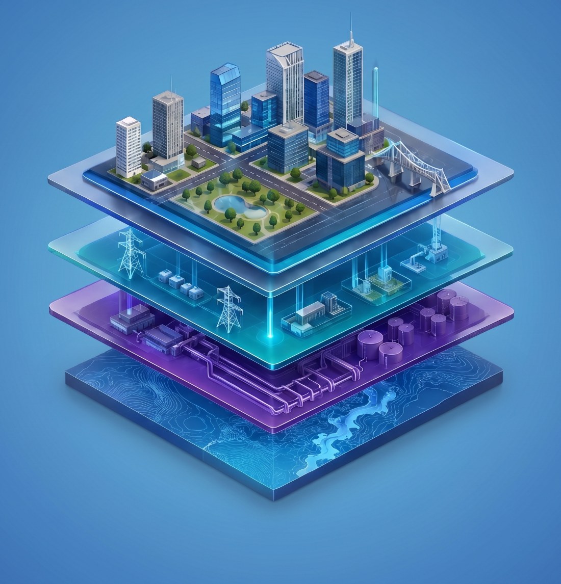
Why cities need a Digital Twin
A Digital Twin lets a city simulate, monitor, and optimise its infrastructure and services in real time — replacing siloed, department-by-department management with one unified platform.
Continuous visibility into urban infrastructure and services as they're built and operated.
Informed, evidence-based decisions in place of siloed spreadsheets and manual coordination.
Scenario simulation and early-warning signals for risks before they escalate.
One digital platform connecting departments, cutting operational inefficiencies and cost.
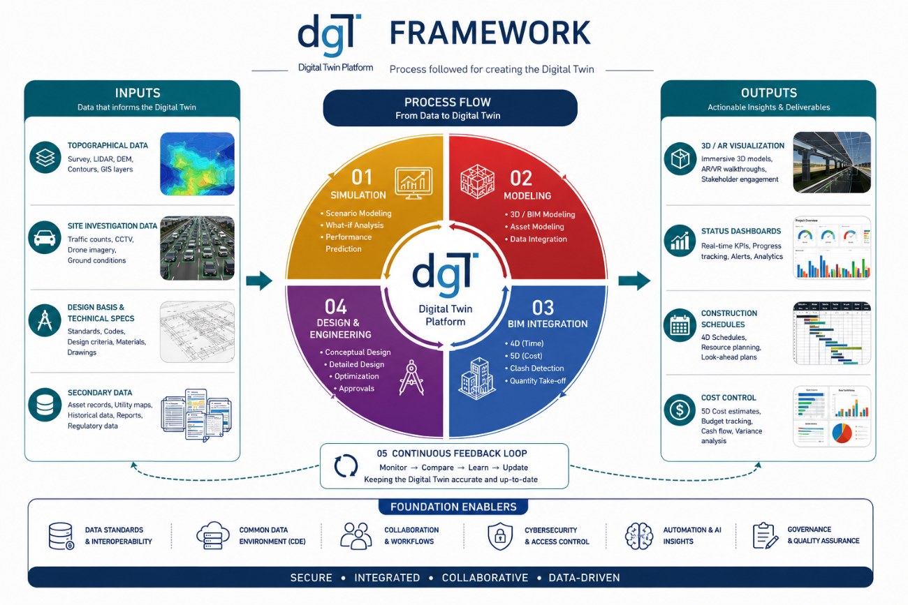
Inputs, modelled and simulated into a single Digital Twin
dgT integrates multiple BIM platforms through specialised, tailor-made plug-ins into one interactive model. Topographical data, site investigation data, design basis and secondary inputs are simulated, modelled, and designed into outputs the project can act on — 3D/AR visualisation, status dashboards, construction schedules, and cost control.
Combined with AI, dgT adds predictive maintenance, real-time monitoring and alerts, automated issue resolution, capacity planning, and forecasting on top of the base BIM data.
dgT vs. conventional design
The same seven-element infrastructure scope, run two ways.
| Criteria | Conventional | dgT |
|---|---|---|
| Approach | Silo | Integrated approach |
| Accuracy | Moderate — relies on human intervention | High — AI-driven plug-ins |
| Team required | Large teams, multiple manual interventions | Smaller, smarter teams |
| Revisions & remodelling | Rework from the beginning — cost & time impact | Automated updates at every stage |
| Useful for | Design only | Design, construction, planning, O&M, risk analysis |
| Construction errors | 2D outputs can lead to errors on site | 3D outputs significantly reduce errors |
| Clash analysis | Manual intervention | AI-driven automated detection & resolution |
| Project monitoring | Spreadsheets, conventional tools | Integrates with planning tools (e.g. P6), 3D planned-vs-actual |
Nearly 60% of the Amaravati LPS layout, on dgT
Kreayotoo Solutions was appointed design consultant by BSR Infratech, NCC Limited and RVR Projects for detailed design across the Amaravati LPS layout — seven infrastructure elements (Roads, Stormwater, Sewer, Power, ICT, Water and Reuse) within a compressed schedule. Working with sister company Urban New, dgT's BIM- and AI-based plug-ins carried the utility design, 3D modelling, clash analysis and GFC preparation.
The resulting BIM-compatible models were imported directly into APCRDA's own Digital Twin platform, zone by zone.

Utility clashes, found and resolved before they reach site
Automated plug-ins flagged conflicts between utilities — Water–Reuse, Water–Storm, Water–Power, Power–Sewer, Power–Storm — and resolved them by adjusting bends, conduit levels and manhole depths, iterating across site, cost and sustainability factors before design experts signed off the clash-free model for construction.


What dgT changes on a live project
Cuts the time taken to design utilities versus conventional workflows
Direct integration of pressurised & gravity design software with the BIM platform
AI-automated clash detection, analysis and resolution
Tailor-made plug-ins for automated GFC-band and label creation
3D visualisation for faster, better-informed decisions
Produces BIM models ready to feed a city Digital Twin — for progress monitoring, O&M and risk assessment
From the Amaravati rollout
A look at dgT's outputs on site — from utility clash models to the zones it has already shaped.

